Click on images to enlarge
|

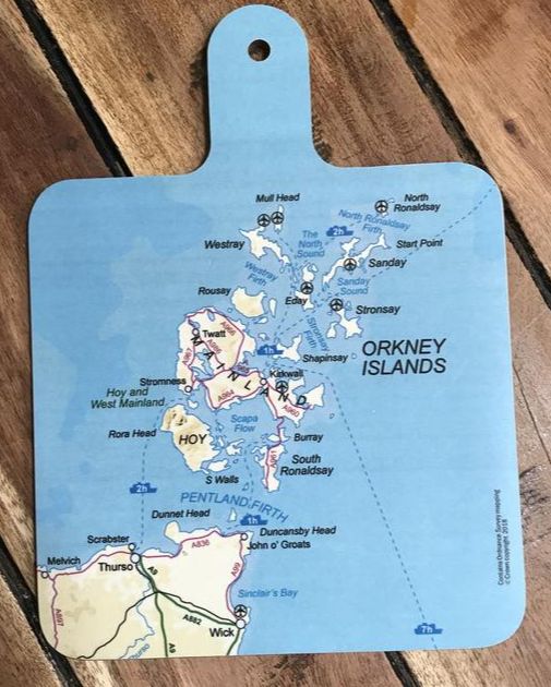
Melamine chopping board (see left) Cushion (2 sizes) Magnetic shopper pad Coaster Pebble-style eraser Magnetic bookmark all featuring the Ordnance Survey map of Orkney. 
|


|
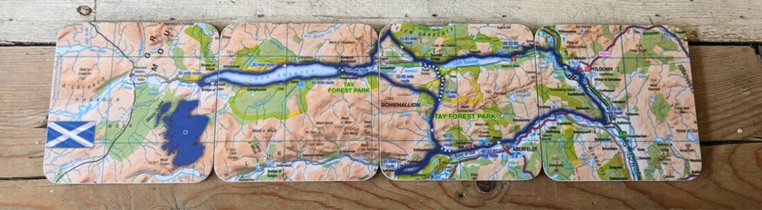
The annual cycling tour based in Pitlochry offers 40, 55 and 80 mile routes. This clever 4-coaster set fits together to show all three routes! |


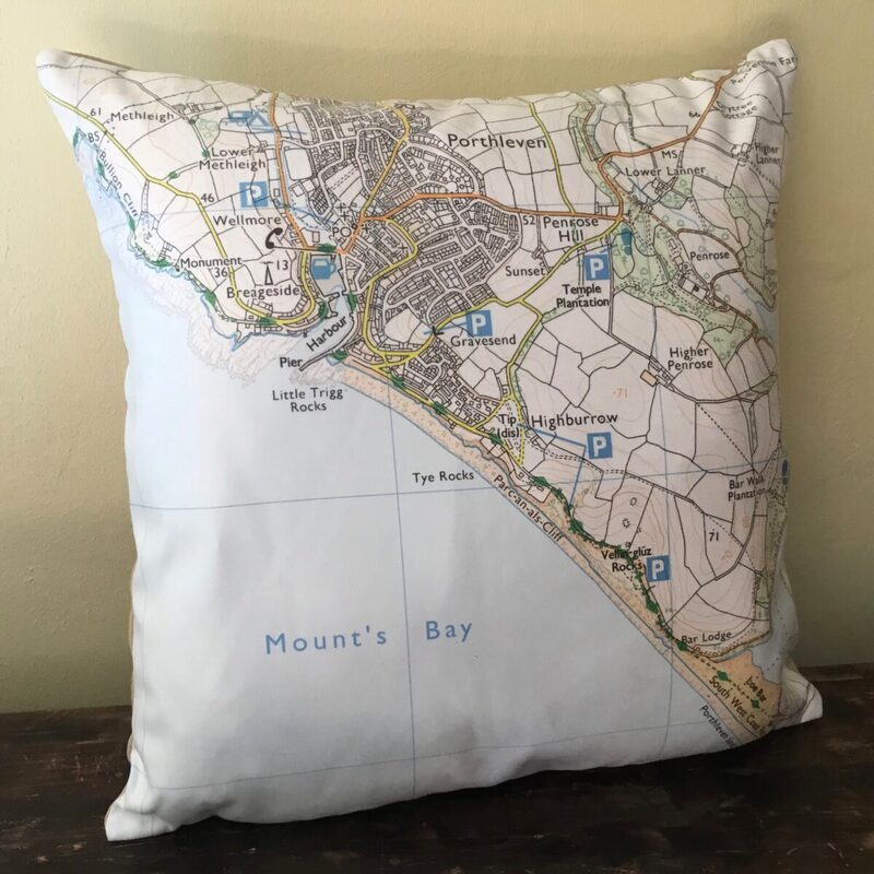
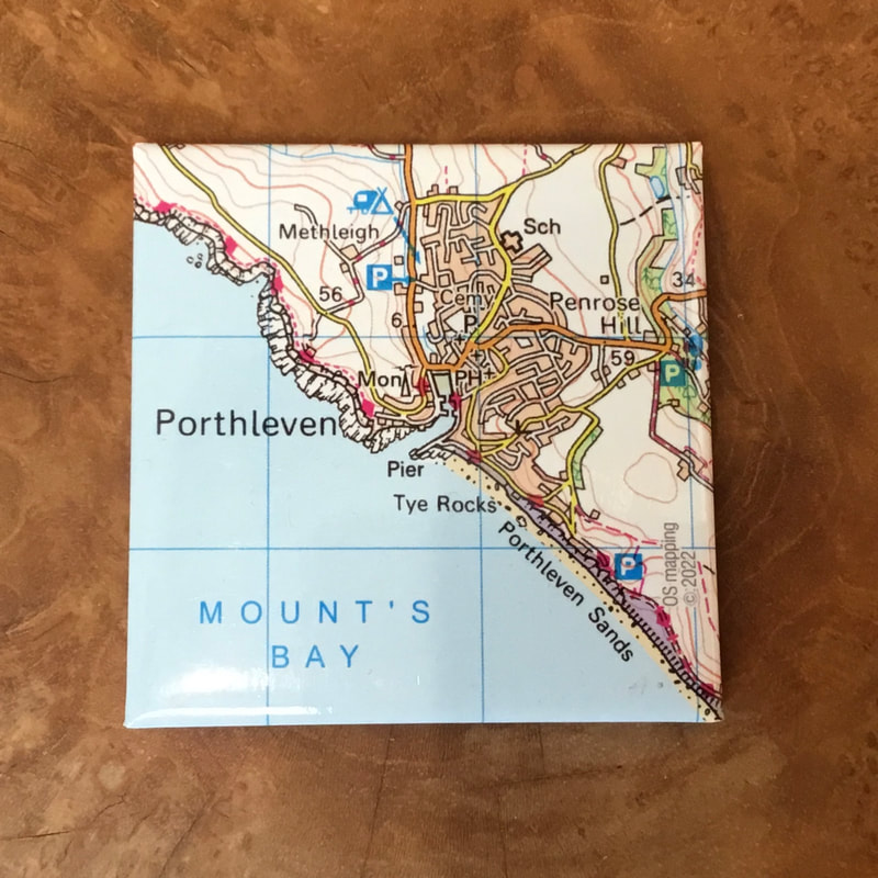
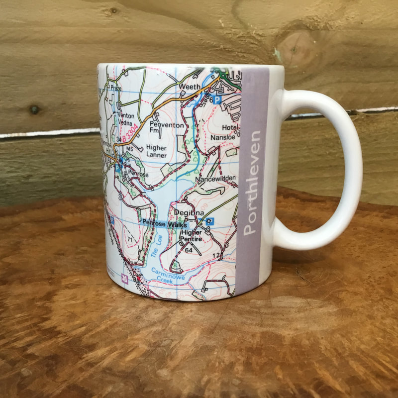
The Ordnance Survey map of beautiful Porthleven in Cornwall on a 45cm cushion with machine washable removable cover; an 11oz ceramic mug; and a 6.4cm square fridge magnet.


|
|
|
|

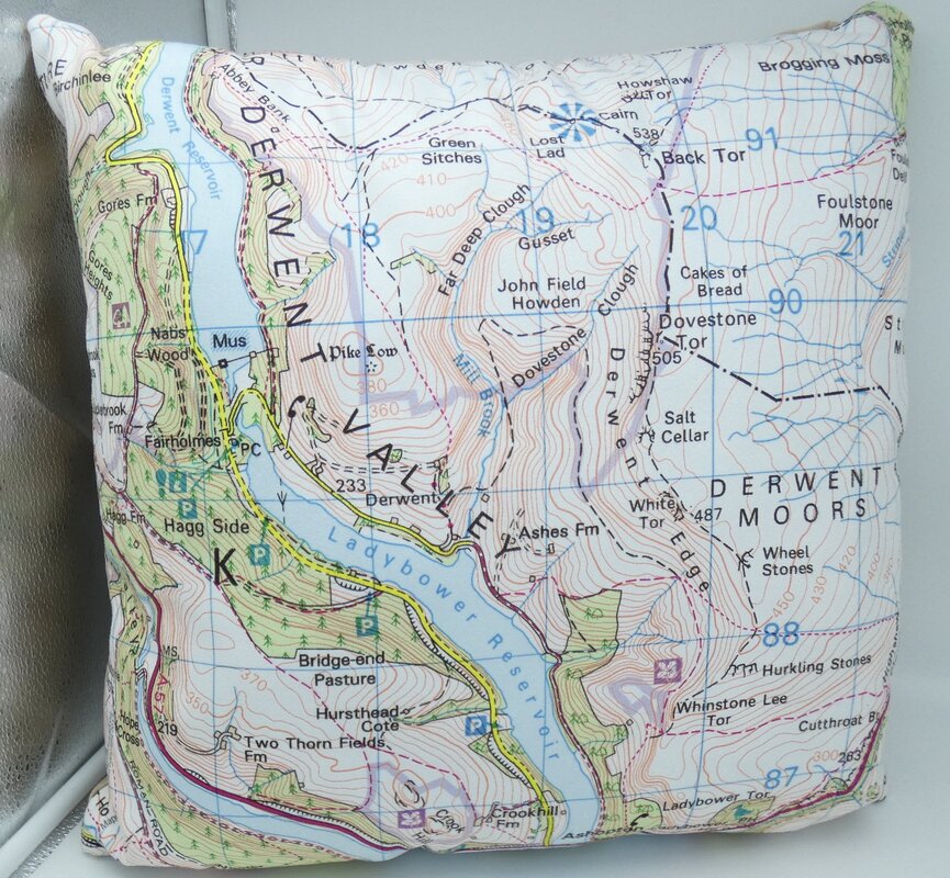
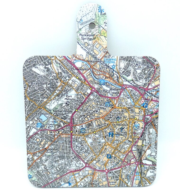
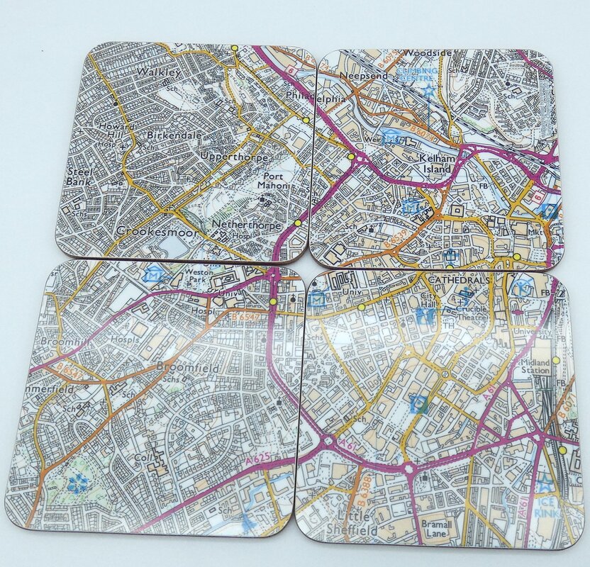
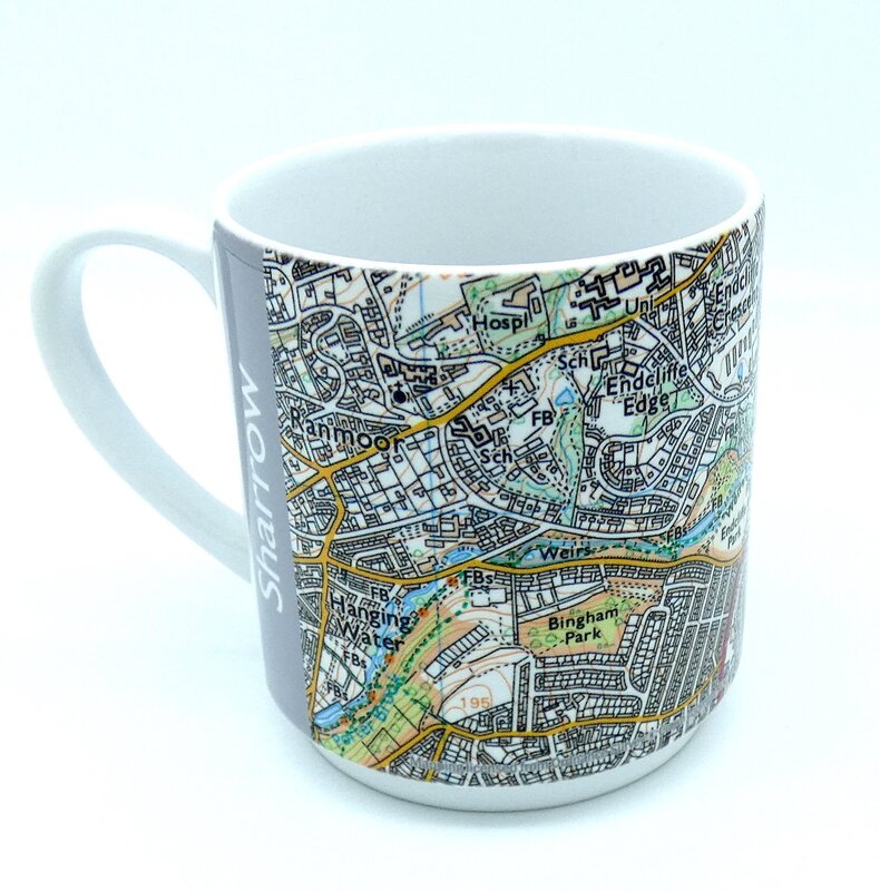
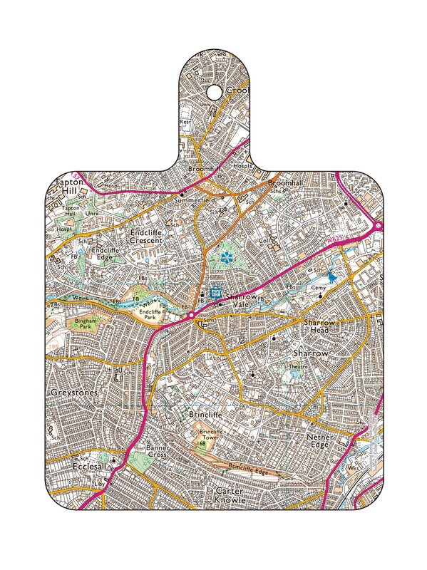
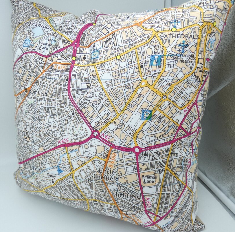
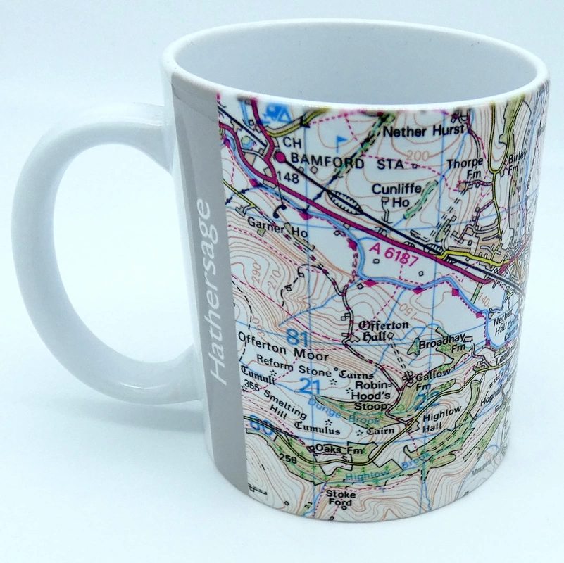
The Ordnance Survey map of Central Sheffield, the Sharrow Vale/Botanic Gardens area, the Derwent Valley, and Hathersage across a range of gifts including coaster sets, ceramic mugs, melamine chopping boards, and cushions.

|


|
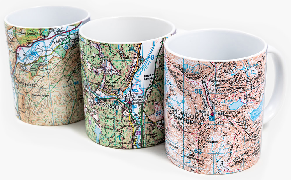
The stunning scenery of Snowdonia/Eryri National Park is now depicted on a range of superb gifts featuring Ordnance Survey mapping.
An 11oz ceramic mug is available in 3 designs:


|
|
|
|
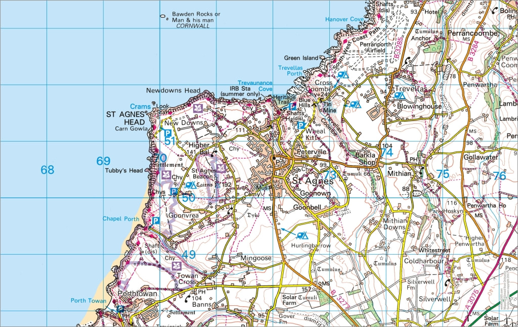
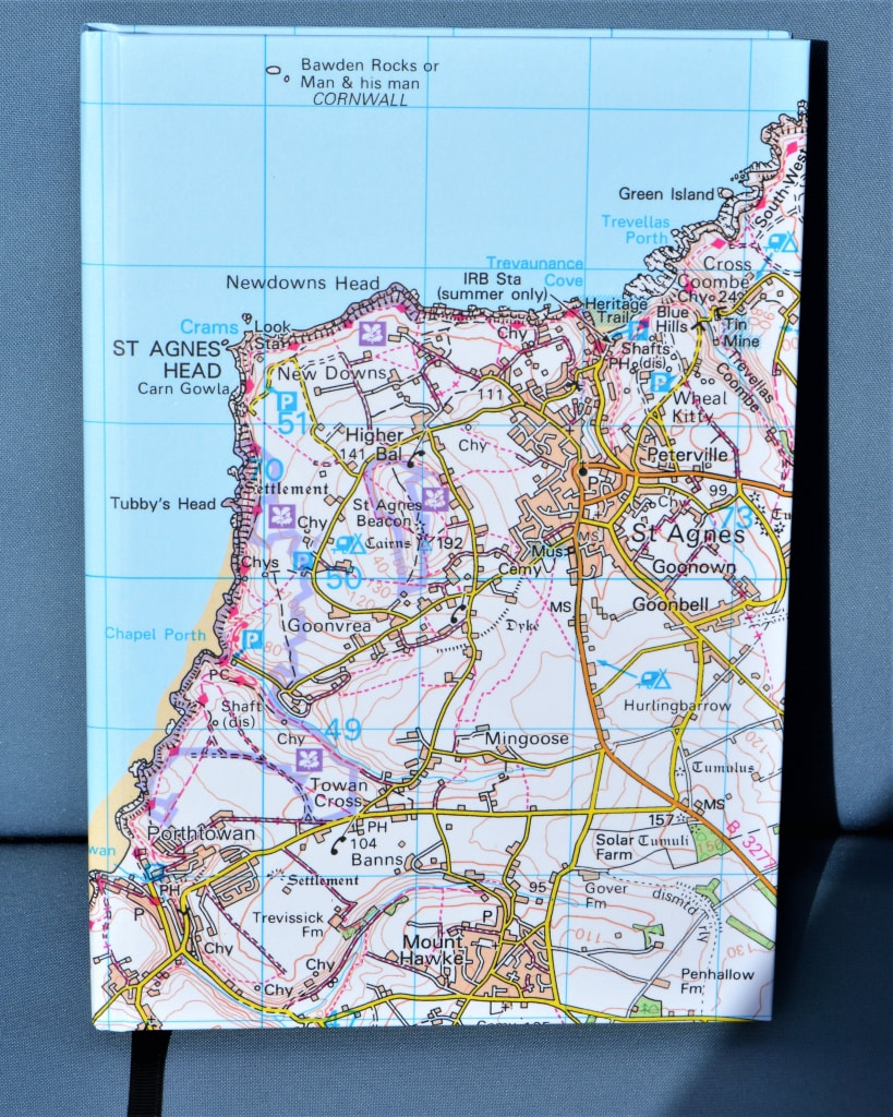
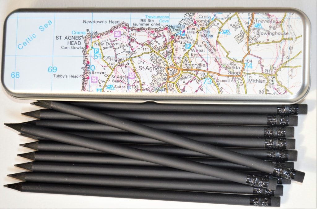
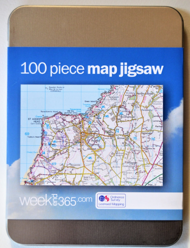
The Ordnance Survey map of St Agnes and surrounding area on a range of gifts including - - 100% cotton tea towel - Colour pencils in wooden box - Hardback notebook - Tin with 12 pencils - 100-piece jigsaw in presentation tin |


|

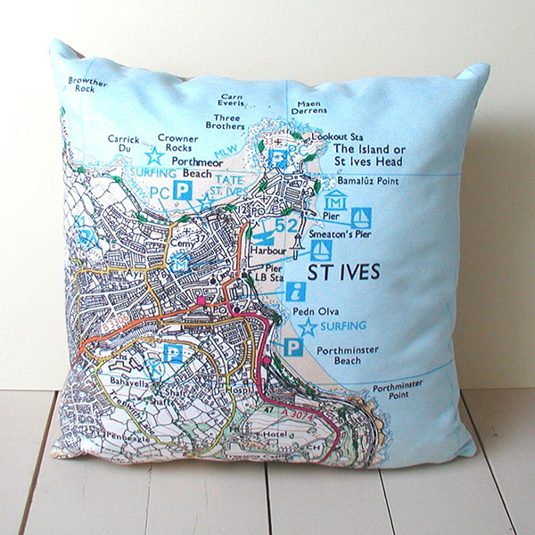
The Ordnance Survey map of St Ives, Cornwall on a 45cm cushion. 
|

|
|

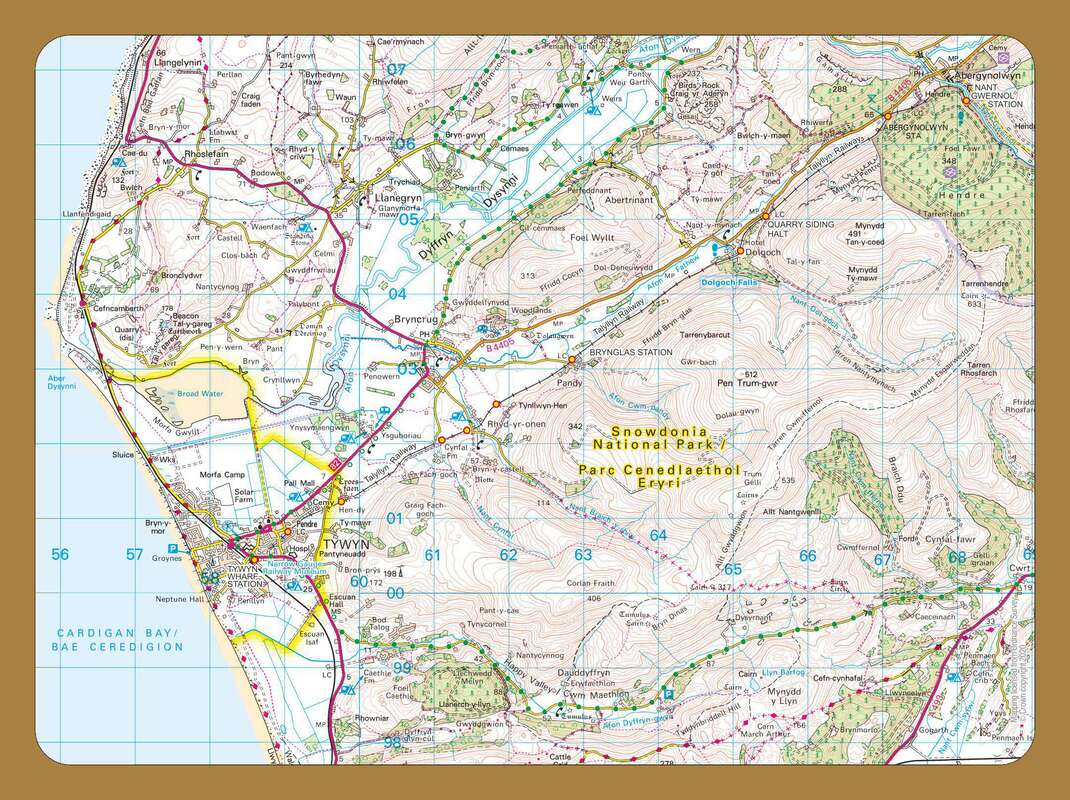
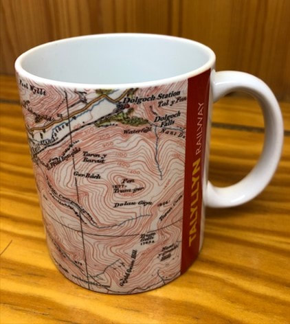
The route of the Talyllyn narrow-gauge steam railway in West Wales shown on current and vintage maps. 


|


|
|
|
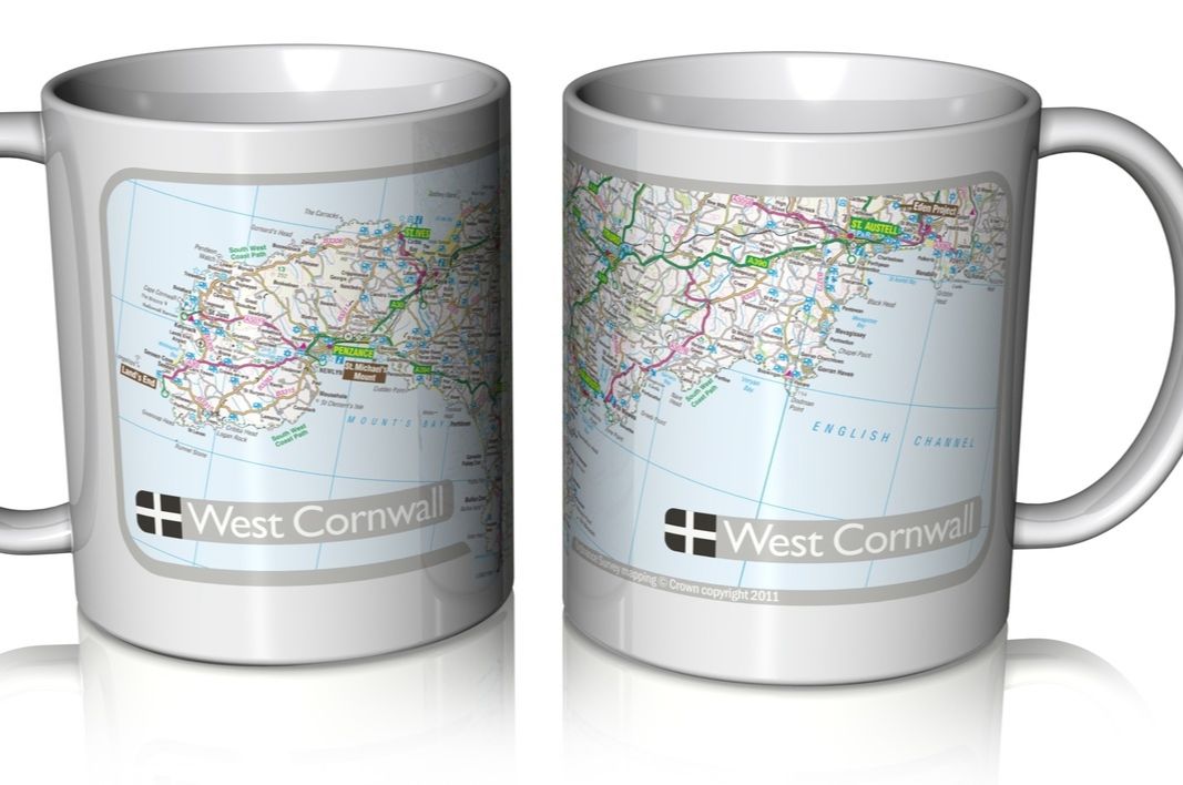
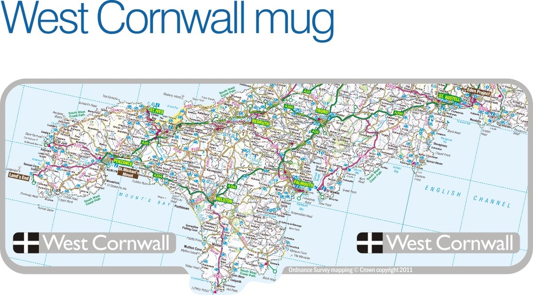
High quality ceramic mug printed with a genuine Ordnance Survey map of West Cornwall, featuring all major tourist destinations.
|

|


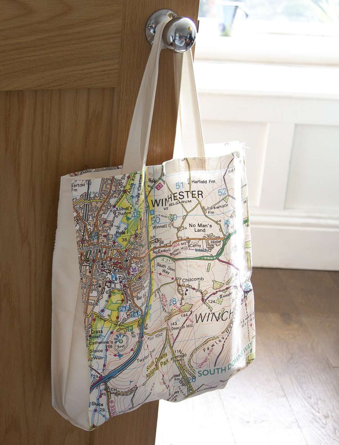
100% cotton canvas tote bag of the South Downs Way, featuring the Ordnance Survey map of Winchester on one side, with Eastbourne and Beachy Head (the eastern end of the Way) on the other. |
|


|
|
|
|
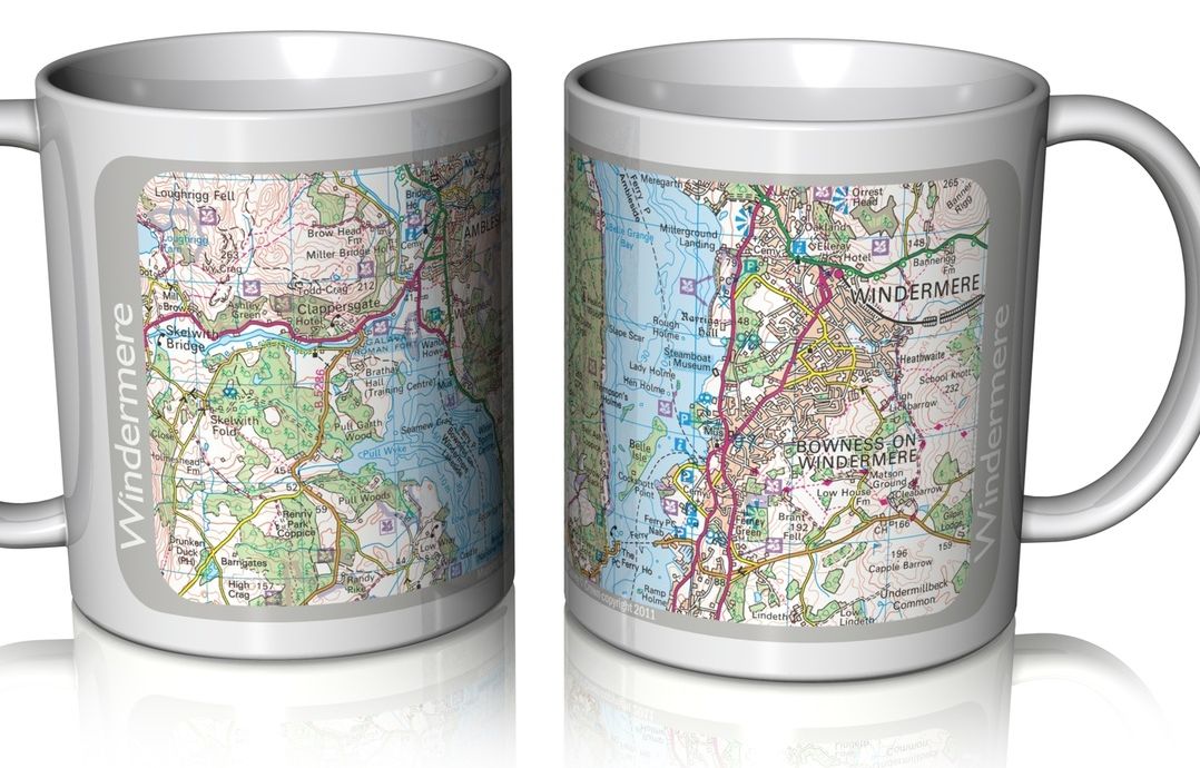
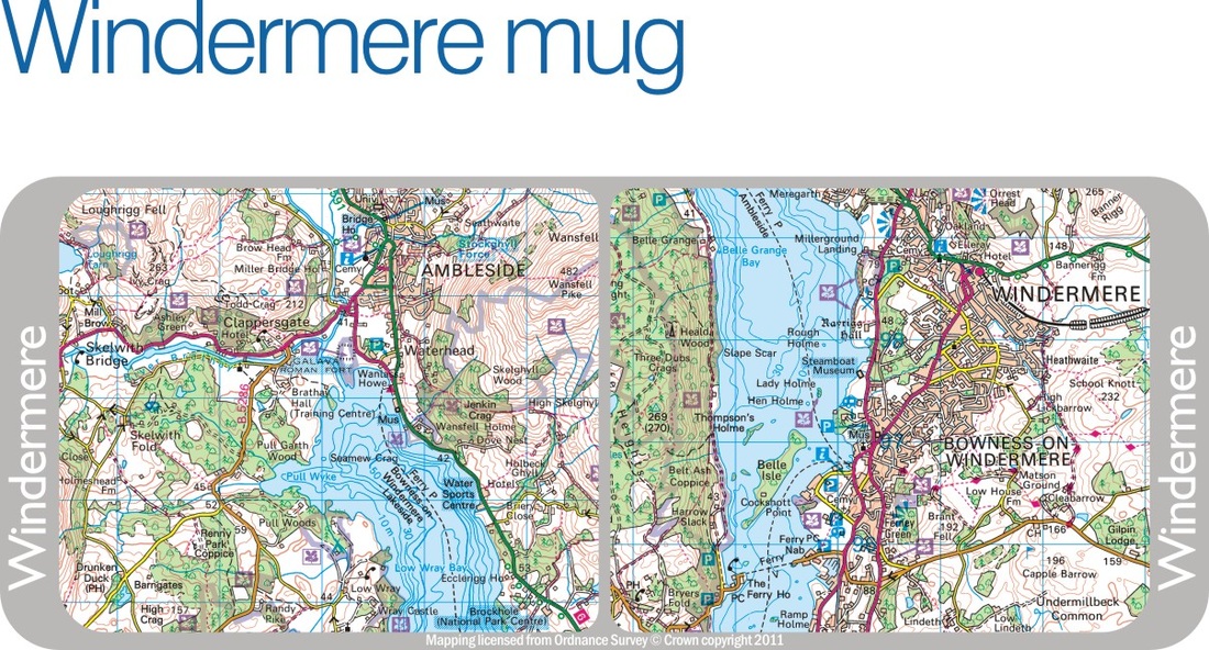
High quality ceramic mug printed with a genuine Ordnance Survey map of Windermere in England's Lake District, featuring the major tourist destinations of Bowness and Ambleside.
|

|

|
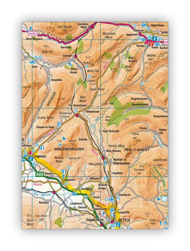
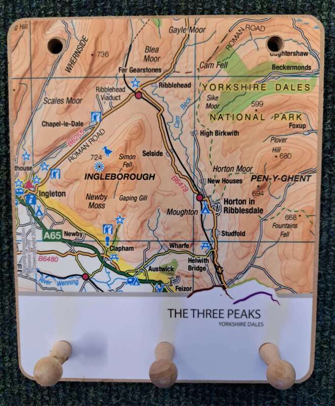
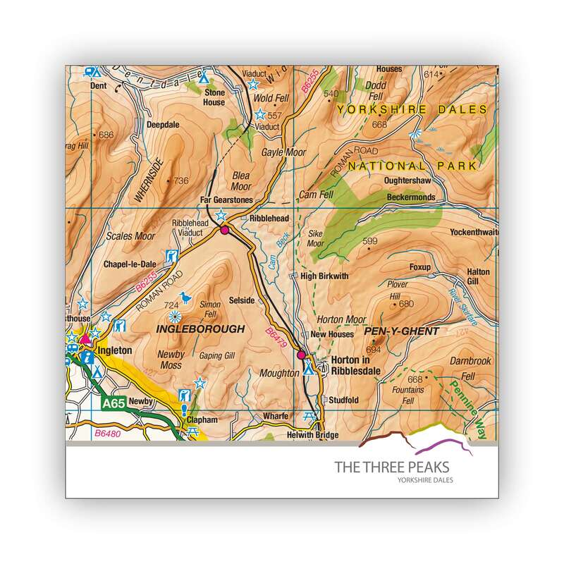
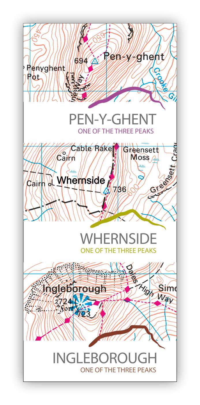
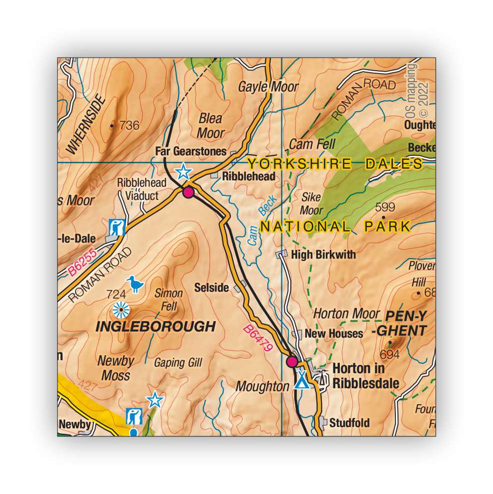
A great range of gifts featuring Ordnance Survey mapping of Pen-y-ghent, Ingleborough and Whernside, collectively known as the Three Peaks. They cover 160 sq kilometres of upland in the west of the Park, rise to 736m at their tallest and form part of the Pennine range that runs through the backbone of central and northern England.


|
|


|

|